
Artem Svetlov aka trolleway is a programmer from NextGIS, as well as a lover of architecture and public transport. He not only rules OpenStreetMap, but also works with data from it every day. In addition, he is interested in shooting spherical street panoramas. Why is he doing this, why can’t he get past OSM and if he has a future - Artem told all this in an interview.
- When and how did you hear about OpenStreetMap?
- In 2011, I registered and started mapping, but I heard about the project earlier: it was regularly mentioned on Habré. However, I thought that in order to become a full-fledged participant, you need a GPS navigator. Because then they wrote everywhere that OSM is a project for rendering GPS tracks for serious tourists. And now, finally, when I got a navigator, I went to WikiOSM to find out what is the best place to start, and found that for several years now the OSM had been drawing a map using satellite imagery.
In OSM, this is always the case - there is always a lack of information about it. Everything about him is known only to his regular contributors.
- Why did you start to draw maps?
- I was attracted by the process itself, as well as the opportunity to do something useful during the usual actions for any person. When your hobby is to draw a map, you can already not just go somewhere or ride a bicycle - you will make it better in parallel. So much more interesting to live.
When I came to the project, the area where I live was already quite well drawn, and 1.5 years before. Then I decided to try to draw villages near Moscow by satellite imagery. But this is not so exciting. As a result, he began to go around the Moscow yards with a leaf in his hands and mark the paths and driveways, because at that time almost everything except the yards was put on the map of Moscow. By the way, at that time many in OSM-RU did this: they printed bypass sheets on the printer and walked along the streets with them.
“What made you do it?”
“I liked that.” It is important to note here that my main hobby is architecture. Moreover, the architecture of ordinary city buildings, roughly speaking - panel houses. I already traveled to certain areas of Moscow, for example, to Orekho-Borisovo and studied buildings, the layout of neighborhoods, and the structure of courtyards. Now, I not only took photographs of houses and the urban environment, but also clarified the map. Combined in time several useful and interesting things for me.
- I know that you took an active part in many free and open projects. What are you interested in?
- The reasons are commonplace. First, experience with open source projects is an important part of a resume. For comparison, few people are interested in working with the editor of People’s Yandex.Maps (hereinafter referred to as “NAC”). Secondly, almost always on the basis of an open project you can do something of your own, even invent something new - in a word, there is freedom and space for experimentation.
Let's go back to the same NAC. There you can only access the web editor, in which you can only do what its creators allowed. And nothing more. In OSM, on the contrary, complete freedom. No tags needed? Come up with your own. Need something else that is not in the project? Feel free to do it, the main thing is that the architecture of the project supports it. And then you can also freely use it for your own purposes.
- When you started drawing a map in 2011, most likely you didn’t know that ...
- This is all written in WikiOSM . I just wasn’t too lazy then and read it.
- It turns out that you do not have much altrius. Or is there anyway?
- Present. In OSM, I painted when I was bored or had nothing to do. At the same time he dreamed that those objects that I would draw would be useful to someone.
- And? Have someone become useful?
- Mandatory. All the data that any mapper contributes to OSM can and is used every day by completely different businesses, researchers and enthusiasts around the world.
First of all, this is a map. If you drew a path in the forest, noted a bakery or put down a house number - any traveler will be happy. Also, data from OSM is downloaded, combed and converted into thematic downloads that help business and analysts work. But OSM is not limited to this. You can give a dozen more examples. Therefore, be sure that your edits are also useful to someone, even if they are completely insignificant.
Every day at work, I see how OSM helps a wide variety of companies. And they all need completely different data. For example, not so long ago there was one project in which the customer needed pedestrian counts in 150 cities of Russia to calculate accessibility zones. Moreover, there still had to take into account a number of nuances associated with the rivers. Enough, the specific task was.
So the next time you think about whether you need to add footpaths to your OSM in your yard, a hairdresser around the corner, a monument on the way to work or not, bring it in. Absolutely any object may be needed by someone.
- Let's talk about another of your hobbies - shooting spherical street panoramas , which you then upload to the Mapillary service. As I understand it, there are not many such enthusiasts in the country. Why and how do you do this? Tell us about it.
- As far as I know, there are 2-3 more such people in Russia. I’m talking about amateurs, not about organizations.
I am an experienced amateur photographer who loves architecture. I am very attracted by the historical pictures of the streets of Moscow. Not even a hundred years ago. The photo taken 15 years ago is already of great interest, since everything is different on it than now: clothes, signs, cars, retail outlets, etc. Then I decided for myself that the more pictures of the urban environment, the better. But in Moscow, all houses are so big that they do not fit into the frame of an ordinary camera. Therefore, I always looked for ways to increase the viewing angle. I bought a lot of fishing lenses, glued a bunch of panoramas. But gluing panoramas is hard. Not in the sense that it is difficult, but a lot of routine: you have to sit and click for many hours in a row. And still it turns out poorly.
When panoramic cameras with acceptable image quality appeared on sale, I immediately bought one for myself. That was at the end of 2016. If anyone is interested, it was the Ricoh Theta S, bought in the USA on Amazon. Now I'm shooting on Xiaomi Mijia 360.
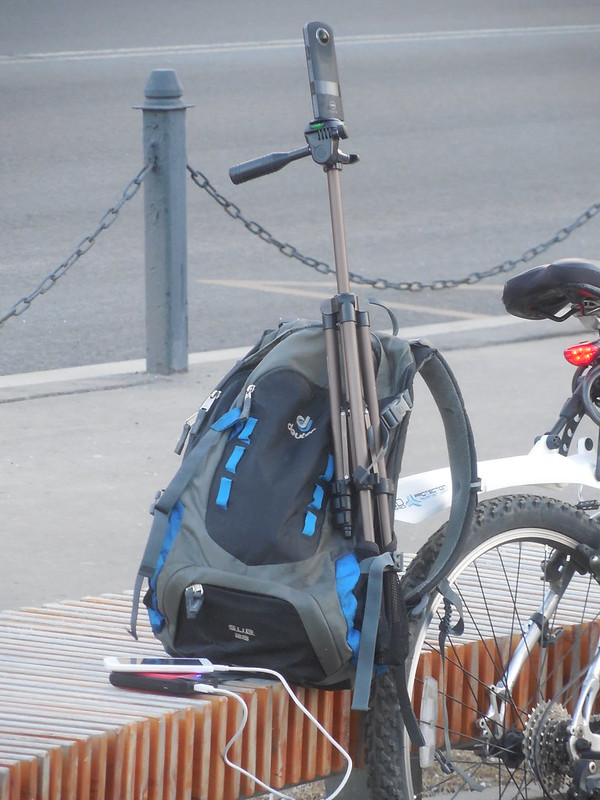
Ricoh Theta S while shooting panoramas of Moscow streets
Shooting with a panoramic camera is a completely different world compared to ordinary photography. Firstly, you don’t have to think about composition, which is the basis of an ordinary picture. You just go and look at home with your own eyes, and not through the viewfinder of the camera. Secondly, you can photograph everything in a row due to the large viewing angle. When you have many panoramic shots, you begin to see those objects or their features that are not visible in ordinary photos. For example, it becomes clear to you how the houses are placed relative to each other and the courtyard is arranged. An ordinary photograph cannot convey this due to the small viewing angle.
For filming, I choose those places that are interesting to me from the point of view of architecture. This is not to say that I am doing this specifically for OSM. My panoramas help OSM become more accurate due to the fact that the Mapillary service, where I upload panoramas, is friends with OSM.
- What is the point of taking street panoramas in Moscow, where almost every corner is shot by Google or Yandex?
- The panoramas of these companies are auto-centric, and I walk. Showing the world through the eyes of a pedestrian. They concentrated their attention on the streets, and I on the yards and public spaces, which none of them rented. In addition, as noted a little earlier, panoramas on Mapillary are laid out under a free license, which allows others to freely use them, including to improve OSM. By the way, in order to shoot panoramas for Mapillary, it is not necessary to have a 360-camera. Enough of a regular phone - there is a special mobile application.
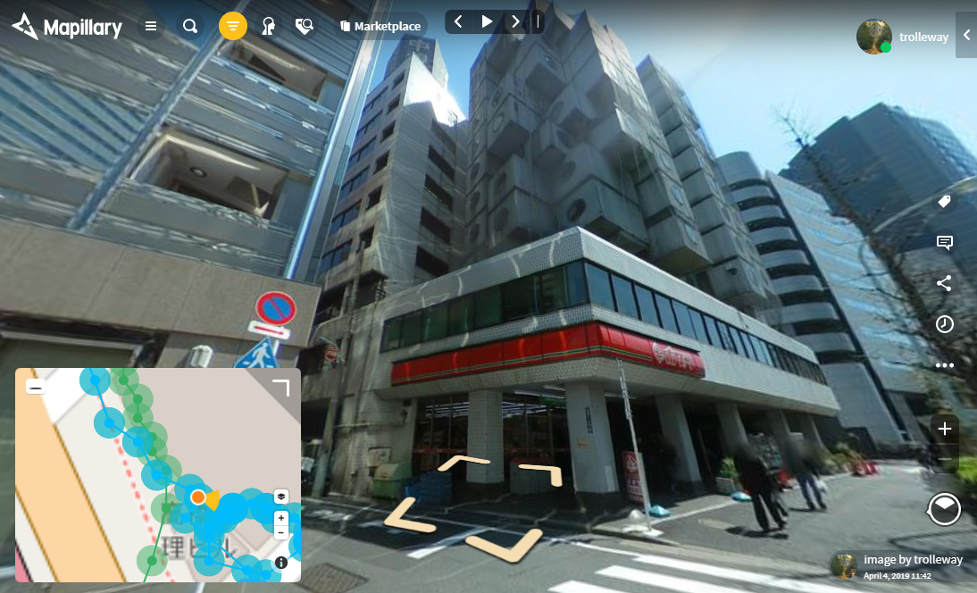
Panoramas of Japanese streets taken by Artem (clicking on the picture will transfer to Mapillary website)
- How is the process of “gluing together” panoramas? Did you write software yourself? Or is it ready?
- It all depends on the number of shots. I usually have a lot of them. Then the processing takes about one business day on the computer. So first, I take panoramas. In parallel, I am writing a GPS track on the phone. Then at home I turn “raw” pictures into panoramic ones. Usually each camera has its own software for this. If not, the nona utility, which is part of the Hugin panoramic image processing package, can help out. It reprograms panoramic images. After that I open the GSP track in the JOSM editor and use the photo_geotagging and photoadjust plugins to “snap” the pictures to the terrain. Next, add a series of tags to the panoramas. To do this, I wrote a simple Python script that adds them through the exiftool utility. Then I run Mapillary scripts that upload photos to them on the server. I also wrote a script that can upload the same pictures to Google Street View.
- But what about OpenStreetCam?
- When I last visited this service, it was impossible to load spherical panoramas there. Moreover, they all have Python 3, and I have Python 2.
- If someone is interested in shooting spherical street panoramas, can they contact you? I am sure many are interested. Especially see your scripts.
- Yes, of course, you can contact me. All my scripts are posted on GitHub . But so far no one has asked about them. You are the first. In general, shooting such panoramas in Russia and uploading them to Mapillary is still a few fun.
- Why should those connected with GIS technologies should pay attention to OSM?
- In order not to reinvent the wheel. There are many technologies in the OSM ecosystem that are used in more serious GIS, as well as in web development, which the programmer may not have come across before. For example, you can find out how the TMS protocol and vector tiles work. Often, it is on these topics that people try to come up with something from scratch, although everything has been implemented and has been working successfully for a long time. On Habré such articles periodically appear where a person shares his discoveries about OSM, which in fact turn out to be the very invention of the bicycle.
Moreover, when working with geodata, it is impossible to get past OSM. Nevertheless, I can safely say that this is the only large and comprehensive free geodata provider. If you make a card, you will almost certainly come across it somehow.
- Does OSM have a future?
- It seems to me that there is. Now it is one of the root parts of the Internet infrastructure. The same as the water supply. No one talks about the Moscow water supply system, but they use it all. Including out of habit and reflexively. OSM has exactly the same story.
- Is OSM as popular as Wikipedia?
- I think no. Everyone knows about Wikipedia, it is even in memes, and about OSM - very few people, even among IT specialists.
- Why?
- This is a rather specific thing that no one advertises.
- Do you know well about OSM in Russia?
- Relatively. And only because he has no alternative. There are many open state geodata in the United States. If you work in some kind of GIS team in America, you can use state geodata. Same thing in Japan and the UK. In Russia, they simply do not exist. Even paid data in our country is difficult to find. But there is an OSM in which Russia is well represented.
- Do you continue to map in OSM now?
- It’s not enough, because I drew all the places that were interesting to me. There is one more thing - the steppe regions of Russia, but I have not yet gathered my courage. There is a lot of work. Now I’m slowly making various derivative products from OSM. For example, railroad maps to illustrate Wikipedia articles. But at the same time, I do not forget about OSM. From time to time I add POIs and notes through the OSMAnd navigator, and also recently I began to make edits through the StreetComplete mobile application, where in a game form - by answering simple questions - you make the map more accurate. Try it, an amusing thing.

rail map for Wikipedia
- Is it worth it to come to the OSM community?
“Of course it's worth it.” There are still many places in Russia that need to be mapped. For comparison. Not so long ago I was in Belarus, and immediately after it - in Volgograd. In Belarus, almost all points of interest (POIs) were noted in cities. I ride a train, look out the window, drive through some small village, and even there is a beetroot dining room. I walk along the main street of Volgograd - empty. Through OSMAnd, I added about 30 stores that were not there. Of course, they have a smaller country and a greater concentration of people, but therefore OSM-RU and the necessary new people. It would be nice if someone advertised OSM in Russia. I really don’t know how and where.
- What would you say to a newcomer to OSM?
- In OSM, you can draw much more objects and indicate their properties, and those that are of interest to you. For example, the shape of the roof or the color of the facade of buildings, which is useful when visualizing data. In addition, much more derivative products can be obtained from OSM: pictures for a blog, maps for navigators, data sets, etc. There are even computer games based on OSM. OSM has much more application, as well as freedom within the project, than its competitors.
New ways to use OSM data are constantly emerging. So read the news about OSM. For example, not so long ago I found out about the MapSwipe mobile application, “playing” in which you can help volunteers of the OSM humanitarian team make a map of the territory where special help is needed for people. And you can do this in the subway when you are driving from work. It seems that the application does a commonplace thing, but with its help you can do something that you never did and get a new experience.
PS There are two videos on the network where Artem Svetlov talks about his experience in shooting panoramas on Ricoh Theta S and Xiaomi Mijia 360 cameras . But if you are interested in asking him questions in person, on November 21, 2019, he plans to make a similar report on “Circuitry”.
Communication of Russian OpenStreetMap participants is in the Telegram chat room and on the forum .
There are also groups on social networks VKontakte , Facebook , but they mainly publish news.
→ Join OSM!
Previous interviews: Sergey Sinitsyn , Natalya Kozlovskaya , Victor Vyalichkin , Ivan aka BANO.notIT , Anton Belichkov , Elena Balashova , Ilya Zverev , Timofey Subbotin , Sergey Golubev .