News from the world of OpenStreetMap No. 475 (08.20.2019-26.08.2019)
Celebrating Solar Panels - UK OSM Community Project for Next Quarter 1 | data OpenstreetMap contributors
Mapping
- Now in the Vespucci mobile editor, users can make their own blanks. Simon Poole tweeted to show how this could be done.
- A Thejesh GN user called on all volunteers to help make a map of CCTV cameras in West and South Bangalore.
- Joseph Eisenberg is awaiting comment on his camping tagging scheme. This scheme is intended to add more campsite features and information.
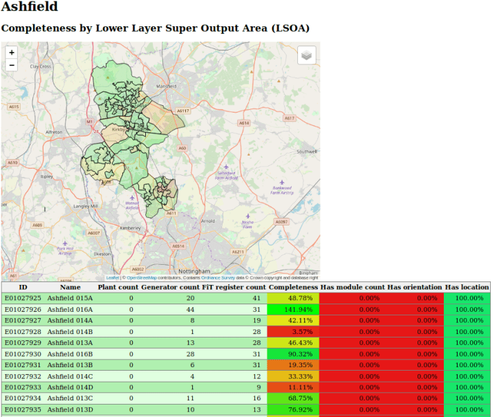
- User SK53 talked about the interim results of a quarterly OSM community project in the UK that maps solar panels. On August 23, almost 67.5 thousand solar installations were brought into the OSM. It is estimated that by the end of the quarter more than 10% of UK solar panels and half of solar power stations will be marked on the map.
- Apple wants to clarify the map of Malaysia for some positions, and therefore is waiting for feedback from the OSM community on this subject.
- EmBH user offers (automatic translation ) to automatically add the
isced:level
tag to all German schools, which indicates the level of education, based on their names. After that there was a discussion of the pros and cons associated with this initiative. - Active Osmer from Malaysia AkuAnakTimur has compiled GPS tracks to help hired GlobalLogic / Grab cartographers avoid common tagging and geometry errors.
- User Lübeck offers
 everyone should note hydrogen filling stations in their localities, since he noticed that much more similar filling stations were noted on the h2.live website ..
Community
- Ilya Zverev recalls that now there is a vote for candidates for the OpenStreetMaps Awards 2019.
- Frederick Ramm answered the question: “Can the OSM Foundation ban organizations from using“ OpenStreetMap ”in their name, even if they previously allowed it?”
- Valerie Anderson in an interview with Maggie Crowley told about herself and her participation in the OpenStreetMap project. Among other things, she told how she got into OSM and how he intersects with some of her works in the non-profit eco-protective organizations Friends of Split Oak Forest and Florida Native Plant Society . In addition, she shared what difficulties she had to face when she tried to push OSM to the masses.
- Among the materials of the 29th International Cartographic Conference there are three articles related to OpenStreetMap. One is about how the augmented reality game (Pokémon GO) affected edits in OpenStreetMap. Another is about predicting pedestrian traffic based on the ANN model and OSM data. And the third is a temporal-spatial analysis of the behavior of cartographers who contribute data to OpenStreetMap.
OpenStreetMap Foundation
- The OpenStreetMap communities in Ireland , the Czech Republic and Oceania (OSGeo) have applied to the OSM Foundation to become official field offices.
- The protocol of the in -person meeting of the OSMF Council of May 18-19, which was held in Brussels, was published.
Developments
- On August 23 and 24, the FOSS4G TOKAI workshop was held in Nagoya (Japan)
 (automatic translation ). The organizer gathered in one place, all tweets related to this event. It is also planned to hold two more FOSS4G conferences in Japan soon : FOSS4G Niigata (automatic translation ) in Niigata and FOSS4G KOBE.Kansai (automatic translation ) Kobe .
Humanitarian OSM
- The nonprofit HOT is experimenting with machine learning. They believe that this can help improve the quality of mapping and make maps even more accurate and better for those people involved in emergency response. HOT hopes that artificial intelligence will help in assessing the size and complexity of mapping tasks, which in turn will evenly distribute the load between cartographers.
Cards
- The citylab.com website has published material about Thomas ’s guidebook - this is an impressive map of the streets of Los Angeles (almost 3,000 pages), which was used by almost everyone, because there were no electronic navigators at that time.
- After a nostalgic article by Laura Bliss, Ilya Zverev remembered that he had a box with printed cards, and wondered why we are not spending so much time looking at cards now. He drew attention to the main problems associated with mobile navigation and popular web maps, and came to the conclusion that in addition to satellite images, OpenStreetMap is the only map that can be thoroughly and deeply studied.
We pass to OSM
- The German Environmental Agency ( Umweltbundesamt ) has launched an online service that shows air quality in Germany. As a substrate, OpenStreetMap is used. The same data can be viewed in a special mobile application (automatic translation ).
Open data
- Guido Gert interviewed (automatic translation ) Professor Paul Becker, who was recently appointed president of the Federal Agency for Cartography and Geodesy of Germany. In an interview, the professor talks about why he decided to take this position and what goals he sets for himself in his new job. He was interested in his statements that they should use OpenStreetMap data more widely in their work, as this is a rapidly developing service and highly motivated cartographers enter data into it. The professor also believes that OpenStreetMap is a data treasure that cannot remain unclaimed.
- In accordance with the law on geological data, the German Federal Ministry of Economics and Energy has developed a bill (automatic translation ) requiring state geological services to provide the public with much more geological data than is currently happening. The law does not say anything about licenses and payment by citizens of this data.
Software
- Christoph Hanser said the Trufi App is now an open source application. It was developed by the Trufi Association and provides information on public transport in Cochabamba (Bolivia). Please disseminate this information so that cities in developing countries can use this app.
Programming
- The gravitystorm user made a pull request on GitHub because he wants OSM to support multiple versions of the API at the same time. For example, he believes that API 0.7 can be started to be implemented using API 0.6. Updating the OSM API to version 0.7 has been discussed since 2009, and therefore the list of what could be implemented is very large .
- Has OpenStreetCam closed its source code? Most likely not . It's just that the project has a small team, and summer vacations are in the yard - this makes it difficult to update on GitHub.
- University of Washington and Yes! Magazine announce a new map and an OSM-based application for people with disabilities in Seattle. These services are designed to help them avoid steep inclines, buildings, and barriers in their path. Currently, a set of standards and tools is also being developed with which it will be possible to conveniently note, for example, the following points: a narrow sidewalk, a problem surface or the presence of ramps, handrails and lighting.
Releases
- On August 19, a new version of JOSM - 15322 was released. In addition to changing the logo, in the new version it became possible to add tags using "hot keys", the display of new MapCSS and Mappaint functions was improved. In addition, there are a bunch of improvements.
- A new version of iD - 2.15.5 has been released. A list of improvements can be found in the comments on GitHub.
- Beaconeer publishing has released a major update to its free iOS application, AnyFinder, which makes it easy to search for POIs. Now the application caches POI sets locally, which greatly accelerated the work with it when choosing the type of POI to search. Also now OSM tags are updated dynamically, which allowed developers to add support for new tags without releasing a new version of the application. AnyFinder 2.0 currently finds 88 different kinds of POIs and supports 63 OSM tags and 198 distinguished tag values.
- Are you curious about what OSM programs are? Here you will find an almost complete list, besides indicating the current version.
Did you know …
- ... how to mark in the restaurant the time during which it serves food? If it differs from the usual
opening_hours
(opening hours), it can be marked asopening_hours:kitchen
. - ... that there is an atlas of traffic accidents in Germany? Not all lands (regions) report traffic accidents, therefore, for example, it might seem that Düsseldorf is perfectly driven.
OSM in the media
- Andreas Baum and other members of the Berliner Taggespiegel team seriously (automatically translated ) analyzed the data on accidents in Berlin, which were recently published. In addition to performing an in-depth statistical analysis, they also noted the locations of accidents on a map based on OpenStreetMap.
Other geo events
- The United States is a large and diverse country. User Inzitarie tried to do the impossible: create a map of US regions that have their own cultural characteristics.
- Austrian National Library with A crowdsourcing online platform is now classifying, marking and determining the geolocation of 5,000 digitized aerial photographs of the 30s of the XX century.
- Most likely, you heard the expression: " All roads lead to Rome! "? The Move_Lab website has developed the Roads To Rome project, which proves that this is true. (We already talked about this in previous issues: 282 , 284 , 285 , 415 ) All roads to Rome and all other routes calculated during this project were laid using the GraphHopper program. Routing is based on OpenStreetMap data.
Communication of Russian OpenStreetMap participants is in the Telegram chat room and on the forum . There are also groups on social networks VKontakte , Facebook , but they mainly publish news.
Join OSM!
Previous issues: 474 , 473 , 472 , 471 , 470 ,
All Articles