How to turn a volcano into a power station using satellites
Ethiopia conjures up pictures of the sandy deserts, the bustling streets of Addis Ababa or the steep slopes of the Symen mountain range - perhaps with a runner somewhere in the background. However, this country is also one of the most volcanically active on Earth, thanks to the East African Rift Valley , which passes right through its heart.
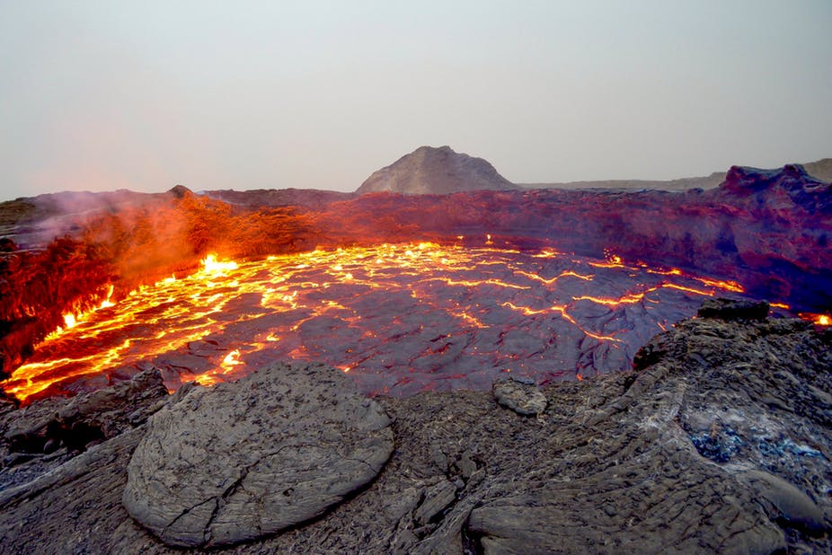
Cracks, or rifts , appear in the geological process, splitting tectonic plates - at about the rate of growth of your nails. In Ethiopia, because of this, magma comes to the surface, and there are more than 60 known volcanoes. Many of them in the past underwent colossal eruptions and left giant craters behind them, dotting the rift valley. Some of them are active today. Visitors to volcanoes can see bubbling puddles of mud, hot springs and a lot of holes from which steam escapes.
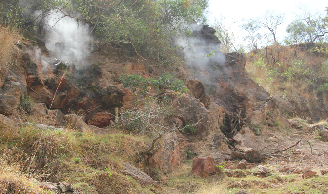
Vapor at volcano Aluto
Locals use this steam for washing and washing, but it contains many more features. Surface activity indicates the presence of extremely hot underground streams, heated, possibly up to 300 ° C - 400 ° C. If you drill a hole, you can achieve this high-temperature steam that can turn large turbines and produce a huge amount of energy. For a country in which 77% of the population does not have access to electricity (one of the worst indicators for Africa), this can mean a lot.
Geothermal energy has recently acquired the status of a serious idea thanks to geophysical surveys, from which it can be concluded that some volcanoes can produce gigawatts of energy. This is equivalent to several million solar panels or 500 wind turbines. The total undeveloped resource of volcanoes is estimated at 10 GW.
The conversion of this energy into electrical energy will be based on a pilot project launched 20 years ago on the Aluto volcano in the lake region 200 km south of Addis Ababa. Its infrastructure is being updated with a view to a tenfold increase in capacity, from 7 to 70 MW. In short, geothermal energy seems like a fantastic solution, using renewable sources and not releasing a lot of carbon dioxide into the atmosphere. This project could be a baseline for the energy sector of Ethiopia, and help get people out of poverty.
What lies on the surface
The main problem is that, in contrast to well-developed geothermal economies like Icelandic, very little is known about Ethiopian volcanoes. For almost all of them, it is not even known when it was the last time it erupted — and this question is critically important, since volcanic eruptions and large-scale power plants are incompatible with each other.
In recent years, the British Environmental Research Council (Natural Environment Research, NERC) has funded the RiftVolc project, a consortium of British and Ethiopian universities and geological researchers, to solve some of these problems. The project focused on the study of threats and methods of development, research and tracking of volcanoes so that they can be operated for a long time and safely.
For three years already, several teams of scientists have been deploying tracking equipment and conducting observations. But one of the most important breakthroughs happened through a completely different channel - through the use of satellite imagery conducted at the table in laboratories.
They led to amazing discoveries related to Aluto. Using satellite radar images, we found that the surface of the volcano is inflated and deflated. The closest is the analogy with the breath - we found that in a few months the volcano takes a sharp "breath", followed by a slow and long, long-term exhalation. It is not yet completely clear to us what causes these ups and downs, but there is every reason to believe that magma, geothermal waters or gases move under its surface at a depth of about 5 km.
Measure temperature
In our recent work, we used infrared satellite imagery to study in more detail the steam coming out of the holes in the ground. We found that the places where the gas comes from, often coincided with the known fault lines on the volcano.
After measuring the gas temperature for several years, we were surprised to find that most of the wells are quite stable. Only a few of them on the eastern slope showed significant temperature changes. And, importantly, they were not synchronized with the "breath" of the volcano - and one would expect that the surface temperature would rise during swelling, when hot liquid rises from the bowels of the volcano.
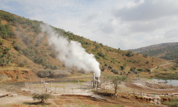
Geothermal well on Aluto
Then we turned to the data on precipitation and found an explanation for this phenomenon: wells with varying temperatures showed a lagging response to rain that fell higher up the slope on the fault. We decided that the rain did not affect the wells near the center of the volcano, and therefore they give the best view of the hottest waters in the geothermal reservoir. Much depends on this when choosing places for drilling wells and building power plants on a volcano.
This is one of the first attempts to track geothermal resources from space, and it perfectly demonstrates the capabilities of this method. Since satellite data is available to everyone, this provides everyone with an inexpensive and safe way to estimate geothermal potential.
Similar volcanoes are scattered throughout Kenya, Tanzania and Uganda, and this technology can help us discover and track new, unused geothermal resources in the rift valley and around the world. It's amazing how much you can detect, moving away and zooming.
All Articles