Westeros and Essos route: cartography of fictional and real worlds

Fictional worlds often become an outlet for the cartographer. Where else can you not hold back your talent and create, enjoying the fact of creating a detailed plan of the area? Even scientists are conducting experiments to create maps on fictional worlds. Researchers from Lancaster University are planning for three years to create a program that will itself extract elements for geolocation from artistic texts and build animated 3D images of the corresponding places on their basis. Train the neural network will begin on the trilogy of JRR Tolkien.
For almost every large-scale fantasy piece you can build a map. Usually the case is limited to the reader’s imagination. Sometimes a real artist or cartographer draws a map — for example, the Becklan Empire map from the Richard Adams novel Shardik, which was drawn by renowned illustrator-cartographer Rafael Palacios, appeared.
It happens that the author of the book draws the map itself. This becomes easier if the events of the novel are based on real stories. Even fantasy with dragons and magic does not appear out of nowhere - the hero needs a route, and the writer needs inspiration. Today, together with MAPS.ME, we will study the basics of the real cartography of “Songs of Ice and Flame” by George R. R. Martin.
Details of non-existent worlds
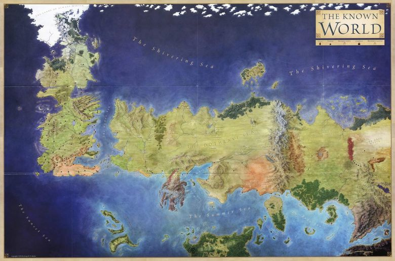
To begin with, let us define that there are two universes of the main modern fantasy saga. There is a series of songs “A Song of Ice and Flame” (also in another translation, “A Song of Ice and Fire” or abbreviated PLIO), supplemented with the prequel of a passing knight, The World of Ice and Fire guidebook, comic books, cookbook, calendars, artubs , posters, maps, games, literary essays, edited by Martin.
If you are not familiar with the world of PLIO, just believe: there are almost more words written about the saga than the five published books of the main cycle contain. Large-scale content is accompanied by a large number of illustrations, in which a special place is occupied by maps. It just so happened that the world of Martin is vast and filled with many small details - the action takes place on several continents, and the characters all the time move somewhere, revealing one location after another.
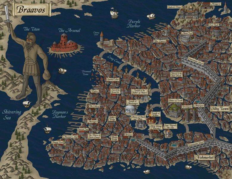
When the artists (and Martin hanging over them) finished with all the vast territories, it was time for the cities. Natalia Rekuts recreated plans for seven PLIO cities, of which the writer is involved only in two. Not canon, but just look at the result - justifies any fiction.
PLIO maps are incredibly detailed (for fictional places). They are supplemented by search, boundaries, scale, footnotes, links to articles, patterns of movement of characters in books, descriptions of places in which the characters in principle have not been. Here you can find a giant interactive map, in which literally all the geodata ever taken from Martin’s extensive work has been added. And here the Russian-speaking community has collected dozens of famous maps of the world, including outdated ones.
The foundation of the real world
The second PLIO universe, which exists in parallel with the first, is being built on television screens - this is the series “Game of Thrones”, in which the action has in some places already surpassed the plot of all the published books and entered the field of obscurity. The series is based on the book basis and the kingdom on television is the same as in the book. The only difference is that Västerås, Essos and other locations appeared not with the help of special effects alone. Filming took place in Ireland, Iceland, Malta and Croatia.
MAPS.ME, together with Kino Mail.Ru found out where the action of the series. Detailed maps of the Game of Thrones appeared in our maps. Tags on the maps, working without the Internet, will help to build a route to the main locations.
(Caution! Next, the spoilers begin. The next section also contains a lot of information focused on those who watched the series and / or read books. If you are not ready for full immersion into the world of PLIO, go directly to the last historical part of the article).
Malta
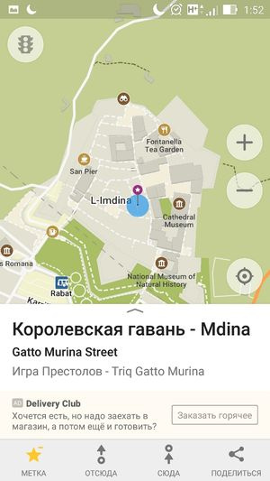
Royal Harbor appeared in the first series of the first season. At the heart of the fictional city lies the ancient Maltese Mdina, which for 4000 years has preserved the beautiful medieval buildings and cathedrals hidden behind the fortress walls.
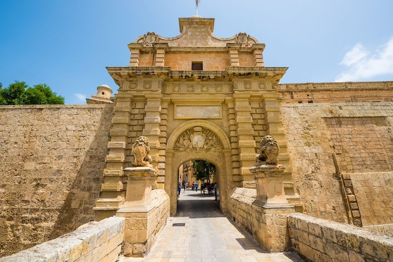
Mdina Gate
And in the first series of “The Game of Thrones” one could see the famous arch located off the coast of Gozo Island (Malta). Unfortunately, at the moment the arch collapsed.
Ireland
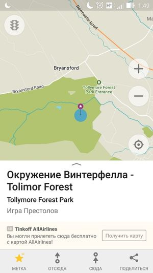
The courtyard and surroundings of Winterfell in reality look almost the same as shown in the series: ruins, rocky placers, bridges, grottoes, caves - they all filmed in Tollymorsky Forest and Ward Castle. In the forest they found puppies of a flyworm, while the sentinel found traces of the presence of the White Walkers.
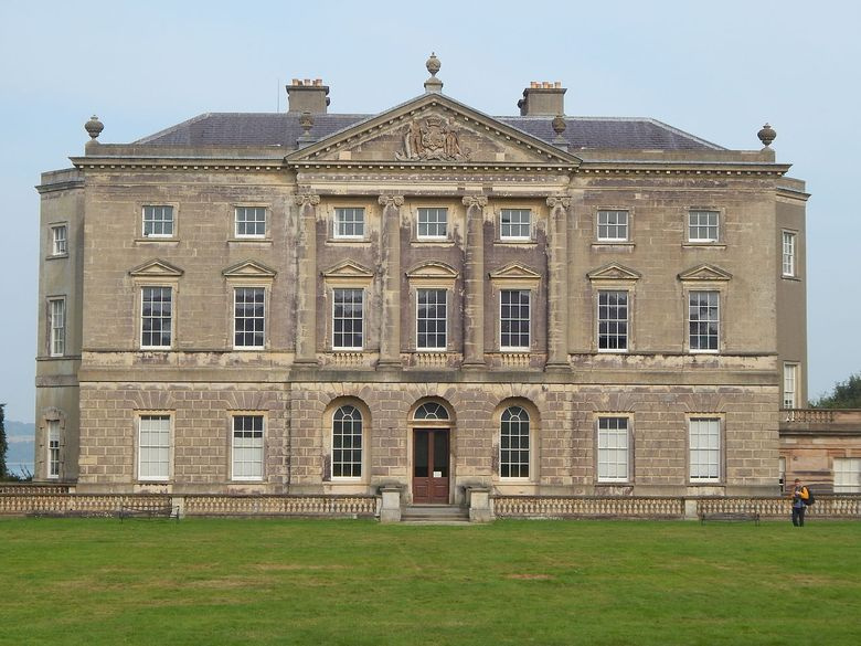
18th century ward castle
The neo-gothic castle of Ward served as the prototype for the Winterfell courtyard. The scene was followed by the arrival of King Robert Baratheon (first season), the bloody return of Theon Greyjoy (third season) and the arrival of Bolton (fifth season).

In the sixth season, Winterfell “moved” to Maniglass, where new scenery was erected in which Ramsey began to rule. From the walls, lined up in Maniglas, Sansa and Theon jumped in order to escape to the sentinel; John Snow returned with a victory to Maniglass with an army of the wilderness, the Little Finger and reinforcements from the valley of Arren.
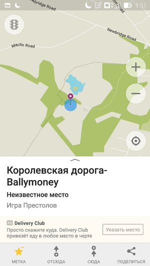
The Dark Hedges beech alley near the Grayshill castle in Antrim was planted in the 18th century. In the Game of Thrones, the alley is easy to recognize - this is the Royal Route, which in the second season little Arya Stark goes to join the Night Watch, and in the fifth season, James Lannister and Brienne Tart say goodbye in a shady alley.

Along the valleys of the picturesque county of Antrim Sans, Stark and Little Finger headed for Eagle's Nest, and the dragon Drogon brought Deineris Targaryen there in the fifth season.
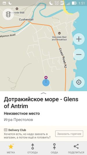
Dothraki sea was not the southern area of Northern Ireland called Shillanavogy Valley. From here Khalasar went to Veyes Dotrak.
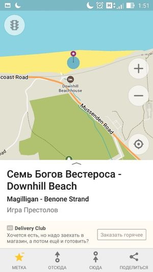
Downhill Beach - 11 kilometers of natural attractions - became the foundation for the residence of Stannis Baratheon. In reality, there is only a small temple built in 1785 - all the scenery painted on the computer. The Kushendan Caves, which were formed more than 400 million years ago, served as the scene for filming scenes at Baratheon Castle.
Shane's castle, built in 1345, became the filming location for the royal tournament in the first season, the prison for Cersei and the last free piece of land for Sansa before her marriage to Ramsey Bolton in the fifth season. After five centuries, it is completely burned out. It is not possible to restore it, but the ruins have become an excellent decoration.

The abandoned quarry Mameramorn is located near the town of Larn. They erected the scenery of the Black Castle - the stronghold of the patrol guarding the Wall. In the same place, thanks to the efforts of the decorators, the winch elevator to the Wall and the gate appeared. The huge Wall itself was painted on a computer.
Iceland
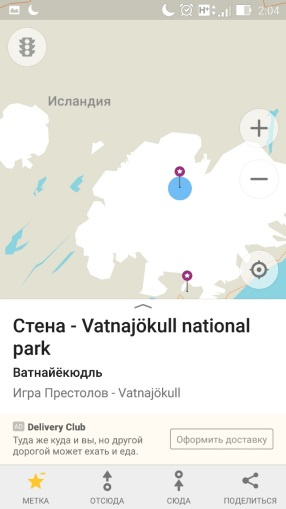

In the caves of Hyofdrebkka, on the Swinawellsjökull and Vatnajökull glaciers, the territory behind the Wall was shot. In the lava fields, Dimmorgorger camped Mans Raider, King of the Wall.
Croatia
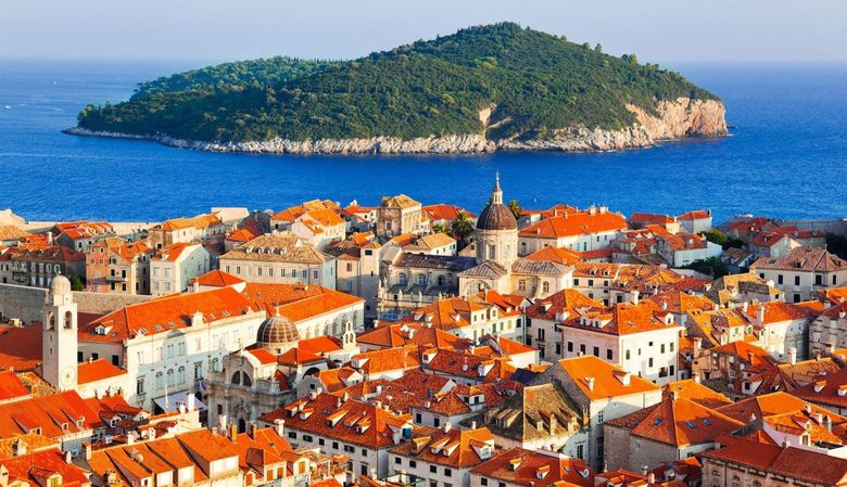
Dubrovnik , Croatia
Trsteno is a small Croatian village where a villa was built in 1492 with the Gucetić-Gozze Arboretum. It was here that shot the gardens of the Royal Harbor, as well as many scenes with Lady Olenna.
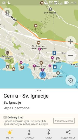
A large concentration of important locations in the same city. The Ethnographic Museum of Dubrovnik became the Little Pink brothel, and the Jesuit Church of St. Ignatius became the great sept of Beylor. That same septa that Cersei destroyed at the end of the 6th season.

Under Dubrovnik is the fortress of Lovrienac, which became the Red Castle.

Another continent of the series - Essos - was filmed on the Croatian island of Lokrum in the Adriatic Sea. Some of the Quart scenery was erected in the city museum of Dubrovnik.
Fiction and truth

Photo source
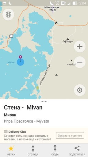
In this whole story, there is one place where fiction, reality and cartography come as close to each other as possible - this is the Wall protecting the Seven Kingdoms from the White Walkers. The wall of Adrian served as a prototype for the Wall - a defensive fortification 117 km long and 4–6 meters high, built by the Romans under Emperor Hadrian in 122–126 to prevent picts and brigades from the north. Val crosses northern England from Irish to the North Sea near the Scotland border. The dimensions of the real wall have nothing in common with the Martin Wall, which is a monolithic block of ice about two hundred meters in height and four hundred and eighty kilometers in length. Here, the writer's neural network clearly allowed herself to wind up the numbers for the sake of entertainment.
All Articles